


DOI: 10.5281/zenodo.23772111 · Zenodo: record · Download: latest release · Docs: tutorial, white paper
CanoPie was developed by Nathan B. Gonçalves during a PhD at Michigan State University, with Scott C. Stark, and continues to be developed at the Smithsonian Tropical Research Institute (STRI), where Nathan B. Gonçalves is now a postdoctoral researcher.
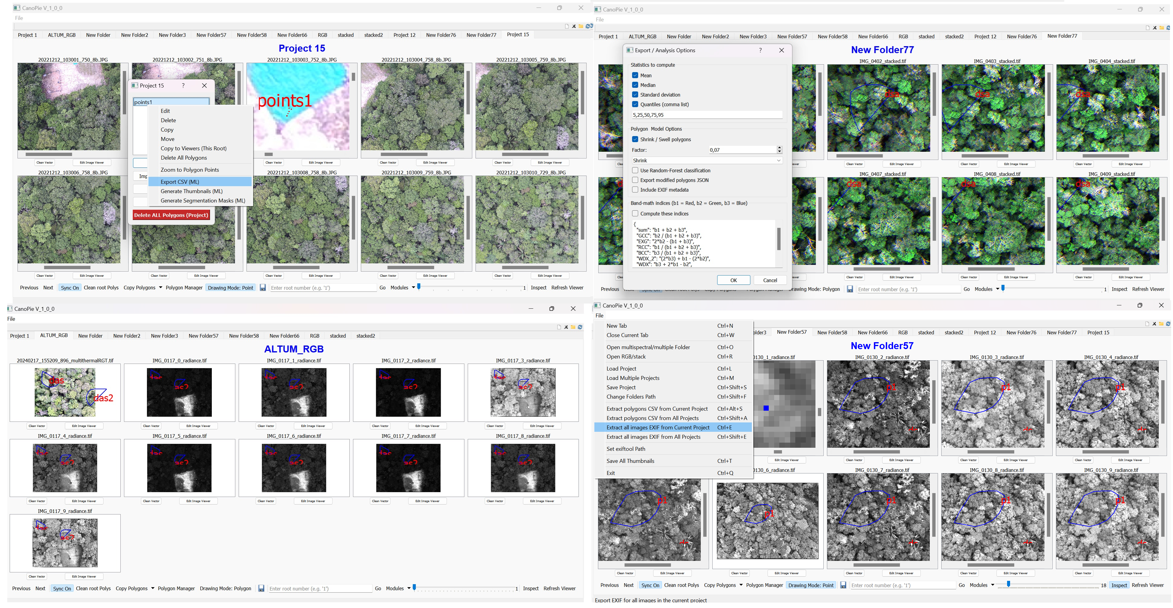
CanoPie is an image analysis tool for RGB, multispectral, and multitemporal data, designed for forest and agricultural canopy studies. With an intuitive PyQt5-based GUI, it enables researchers to process UAV and phenocam imagery (multispectral, thermal, and RGB), draw and manage polygons for data extraction, compute image statistics, and retrieve metadata directly via ExifTool, all without relying on heavy photogrammetry pipelines. Canopie's core functionality relies on libraries such as OpenCV, tiffile, and PyQt5.
Unlike orthomosaics, which can distort radiometry and demand large storage and computing resources, CanoPie provides fast, direct access to raw image data while preserving metadata and maintaining spectral integrity.
Orthomosaics are useful for mapping when you need , but they come at a cost:
- *Require resampling and interpolation, which alters pixel values.
- *Blend across overlaps in the stiching process, often smoothing or distorting radiometry.
- *Add artifacts, shadows, or inconsistencies due to geometry and illumination differences.
- *Can be computationally intensive and storage-heavy.
- *For many ecological and forestry applications — such as monitoring specific trees, crown patches, or hundreds of individuals over time — orthomosaics are not necessary. - *CanoPie provides a faster, lighter, and more spectrally faithful alternative.
New to CanoPie? The tutorial walks through every feature on a small example project
you generate in one command (python examples/make_example_project.py).
Download CanoPie-<version>-windows.zip from the latest release,
unzip it anywhere and run CanoPie.exe. The optional accelerators (numba) and the XGBoost / LightGBM
classifiers are left out of this build; install from source (below) if you need them.
Before you begin, ensure you have the following installed:
- Python 3.10
- The required libraries listed in
requirements.txt - ExifTool by Phil Harvey if you need exif data information from imagery
CanoPie has been developed and tested on Windows 10/11.
The test suite also runs on Linux (Ubuntu) in continuous integration; macOS should work but is not tested.
-
Install Miniconda/Conda (if not already installed)
Download and install Miniconda for your operating system from:
https://docs.conda.io/en/latest/miniconda.html -
Create and activate environment
conda create --name canopie-env python=3.10 -y
conda activate canopie-env- Clone the repository (if you haven't already) or download the raw file (on the top) and extract from zipfile anywhere in your computer:
git clone https://github.com/Nathanborg/CanoPie.git- Navigate to the project directory (Folder where CanoPie was stored and extracted where main.py is stored)
cd CanoPie- Install dependencies
pip install -r requirements.txt- Run CanoPie
python main.pyOr install it as a package, which adds a canopie command:
pip install .
canopieRight-click a polygon (in a viewer or in the Polygon Manager; several polygons can be selected) and choose Find canopy in other images…. CanoPie locates the same crown in:
- orthomosaics of other dates, coordinate systems and resolutions (GeoTIFF georeference);
- raw UAV frames, from their EXIF GPS and a camera model -- GPS-only cameras such as the FLIR Duo Pro R and MicaSense are calibrated from the overlap of consecutive frames of their flight line -- and back from a raw frame to an orthomosaic or to another flight's frames;
- phenocam images, matched in image coordinates.
Images can come from the current root, every root of the project, or other folders / projects (one or several,
each folder treated as one flight). The crown is registered with StackReg (rigid body) or an exhaustive
rotation and shift search, saved as the same polygon group on each image, and can be reviewed (moved, reshaped,
rejected) in the canopy browser. Export crowns writes, per crown, the source crop and every image's crop
over the same ground and orientation, each at its own image's original resolution (GeoTIFF or JPEG), a metadata
CSV, and the crown on every crop as CanoPie polygon files: each crown's folder (by default in canopy_exports
inside the project) opens in CanoPie with File > Load Project.
pip install -r requirements-dev.txt
python -m pytest canopie/qc -q -p no:cacheprovider
A feature-level report is written to canopie/qc/last_run_report.txt. See CONTRIBUTING.md.
Bug reports, questions and pull requests are welcome through the issue tracker; see CONTRIBUTING.md.
CanoPie is released under the MIT License.
If you use CanoPie in your research, please cite it:
Gonçalves, N. B., & Stark, S. C. (2026). CanoPie: A Graphical User Interface for Multitemporal Canopy Imagery Data Analysis (Version 1.1.0) [Computer software]. Zenodo. https://doi.org/10.5281/zenodo.23772111
This DOI always resolves to the latest version; each release also has its own DOI on
Zenodo (1.1.0: 10.5281/zenodo.23772112). GitHub's
"Cite this repository" button (from CITATION.cff) gives the same reference in APA and BibTeX.
CanoPie is an early-stage collaborative project intirelly python-based developed by and for the research community. As a project in active development, it welcomes contributions from researchers, developers, and users interested in advancing open-source tools for environmental and agricultural monitoring.